The Nerve Centre of the War
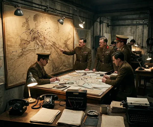
The Map Room is the most important single room in the Churchill War Rooms. From the moment it became operational on 27 August 1939, just days before war was declared, it was never left unattended. For six continuous years, officers worked in rotating shifts to ensure that someone was always monitoring the progress of the war.
When you step inside the Map Room today, you are looking at exactly the same scene that greeted the last officer to leave in August 1945. The maps have not been changed. The pins have not been moved. The telephones sit where they were placed. It is one of the most perfectly preserved wartime spaces anywhere in the world.
How the Room Worked
The Map Room functioned as a real-time information hub. Intelligence reports arrived constantly from military commanders, embassies, and intelligence services around the world. Officers would update the wall maps to reflect troop movements, naval positions, and air operations. Different coloured pins represented different forces, and string was used to trace convoy routes across the Atlantic.
Each morning, the Map Room staff prepared a daily summary for Churchill and the War Cabinet. The story of what Churchill did with those briefings is told in detail in the Churchill Museum, located in the same complex. These summaries were crucial documents that informed the most important military decisions of the war. The Prime Minister visited the Map Room frequently, sometimes in the middle of the night, to check on developments.
The Wall Maps
The walls are covered with large-scale maps of every theatre of operations. There are charts showing the Atlantic, the Mediterranean, the Pacific, and the European continent. Each map tells its own story through the positions of the pins and the marks made by the officers who worked there.
The Atlantic chart is particularly significant. The Battle of the Atlantic was the longest continuous military campaign of the war, and tracking the positions of convoys and German U-boats was a matter of life and death. Every ship sunk, every convoy that got through safely, was recorded on these charts.
The People Who Worked Here
The officers who staffed the Map Room came from all three services. Royal Navy officers tracked shipping and submarine warfare. Army officers followed ground campaigns. RAF officers monitored bombing raids and air defence. They worked together in close quarters, sharing information and building a comprehensive picture of a war that spanned the globe.
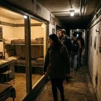
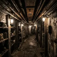
Working conditions were far from comfortable. The room was underground, artificially lit, poorly ventilated, and noisy. Officers worked long shifts under enormous pressure, knowing that the information they processed directly influenced decisions that affected millions of lives. Despite this, morale was reportedly high. The Map Room staff understood the importance of their work and took immense pride in it.
A Frozen Moment in Time
What makes the Map Room so remarkable as a historical site is the decision to leave it exactly as it was. When the war ended, the rooms were simply locked up. There was no attempt to tidy things away, archive the maps, or clear the desks. This means that visitors today see the room in its working state, a frozen moment from the summer of 1945.
The pins on the European map show the Allied positions at the end of the war. The Atlantic chart shows the final convoy routes. The daily log lies open at its last entry. It is this authenticity that gives the Map Room its extraordinary power as a historical space.