Ditchling Beacon
East Sussex's highest point — an Iron Age hill fort on the South Downs with sweeping views across the Weald
East Sussex's highest point — an Iron Age hill fort on the South Downs with sweeping views across the Weald
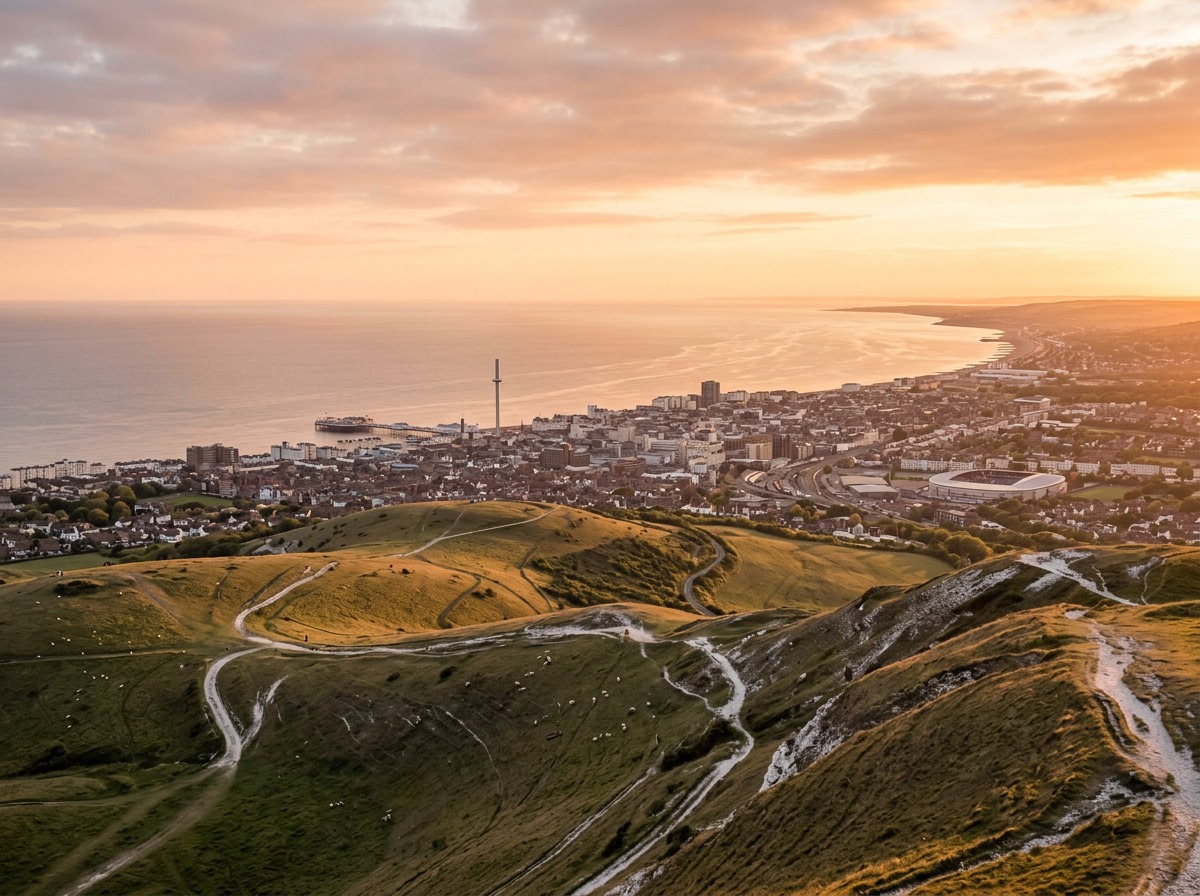
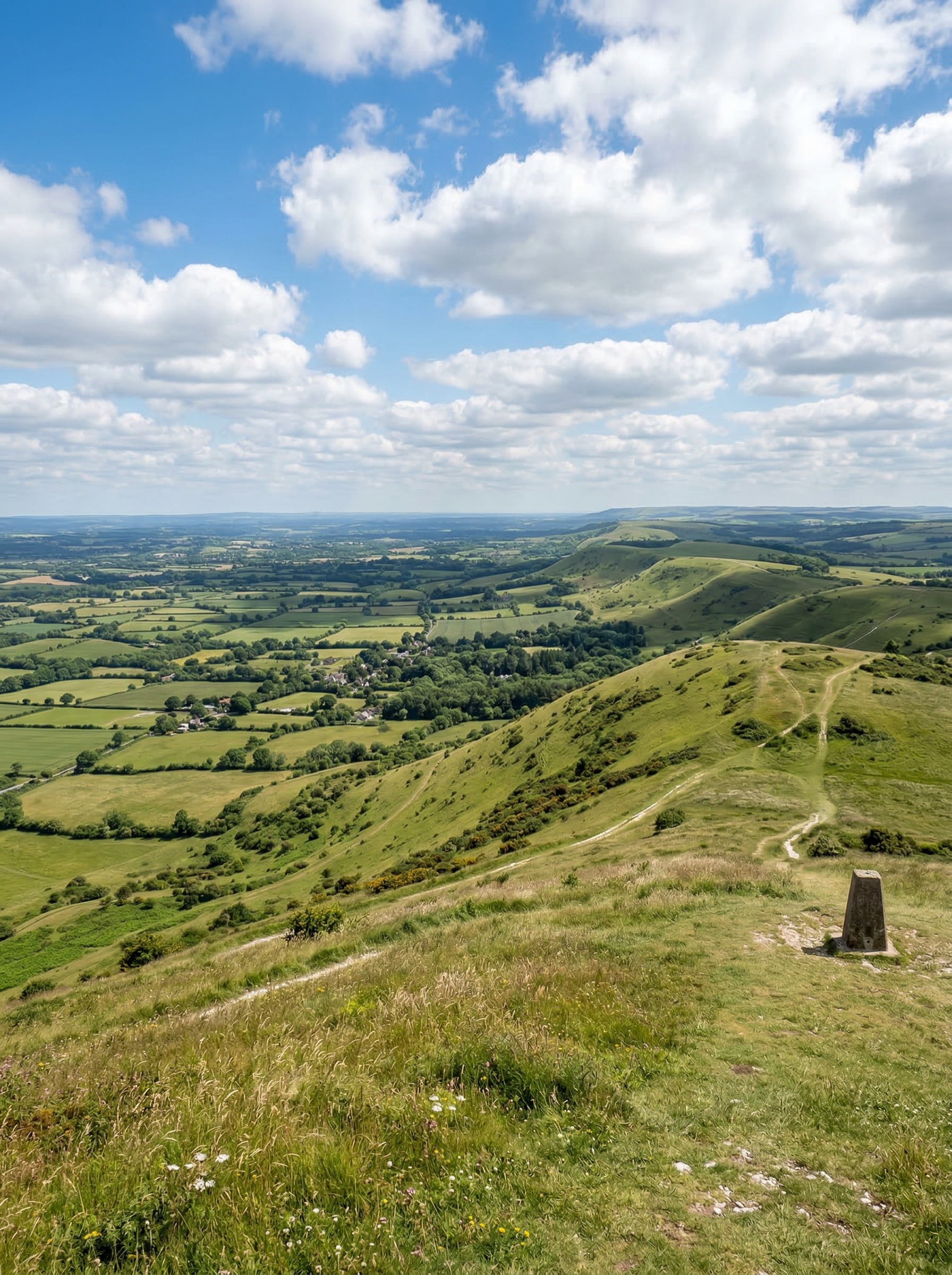
Standing 248 metres above sea level, Ditchling Beacon is the highest point in East Sussex and the third-highest summit on the South Downs, after Butser Hill and Crown Tegleaze. The site sits on the chalk ridge of the South Downs Way national trail, roughly seven miles north of Brighton, and has served as a lookout point for thousands of years — from the Iron Age communities who built a hill fort here to the Tudor beacon-keepers who lit fires to warn of the Spanish Armada in 1588.
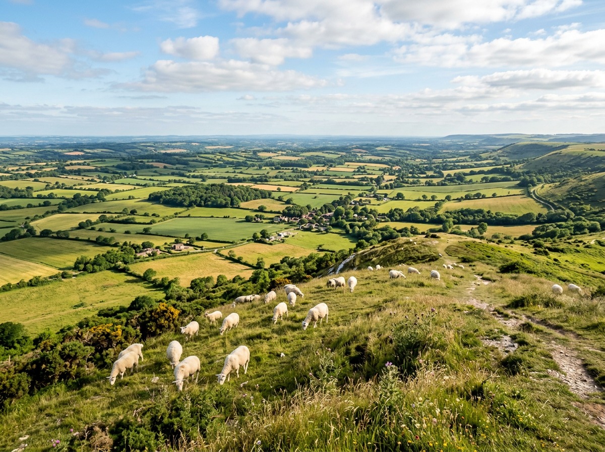
Today the Beacon is managed by the National Trust and falls within a 24-hectare nature reserve overseen by the Sussex Wildlife Trust. The steep northern escarpment supports some of the finest chalk grassland in southern England, home to rare orchids including the honey-scented musk orchid and the dark pink marsh fragrant orchid. On clear days the panoramic views stretch north across the Low Weald to the Surrey Hills and south over Brighton to the English Channel.
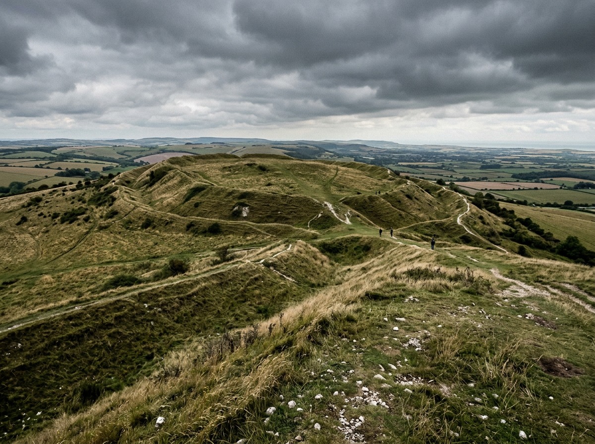
Ditchling Beacon crowns the chalk escarpment of the South Downs seven miles north of Brighton, rising 248 metres above sea level to become East Sussex's highest point. The hill has been a strategic vantage point for millennia. An Iron Age community built a hill fort on the summit, enclosing it with banks and ditches that remain partially visible on the north and east sides today. Nearby, a cluster of Anglo-Saxon burial mounds adds another layer of archaeological interest to this ancient landscape.
The name "Beacon" dates from the Elizabethan era, when the hilltop formed part of a chain of signal fires stretching across southern England. In 1588, these beacons were lit to relay news of the Spanish Armada's approach along the Channel. The summit continued to serve as a signalling station through the Napoleonic Wars before falling into quieter agricultural use during the nineteenth century.
The steep northern face of Ditchling Beacon is managed as a nature reserve by the Sussex Wildlife Trust, forming part of the Clayton to Offham Escarpment Site of Special Scientific Interest. The 24-hectare reserve protects some of the finest unimproved chalk grassland in southern England — a habitat that has declined by over 80 percent nationally since the 1940s.
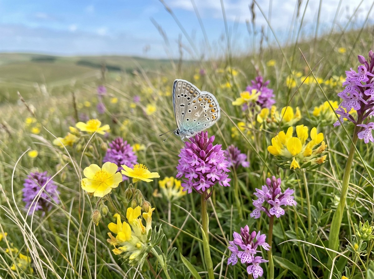
Between June and August the slopes come alive with wildflowers. The rare musk orchid, honey-scented and limey-green in colour, grows here alongside the dark pink marsh fragrant orchid found on the cooler north-facing scarp. Butterflies including the chalkhill blue, Adonis blue and marbled white feed on horseshoe vetch and kidney vetch scattered across the thin chalky soil. Skylarks nest in the rough grassland, and kestrels hunt the slopes for voles and field mice.
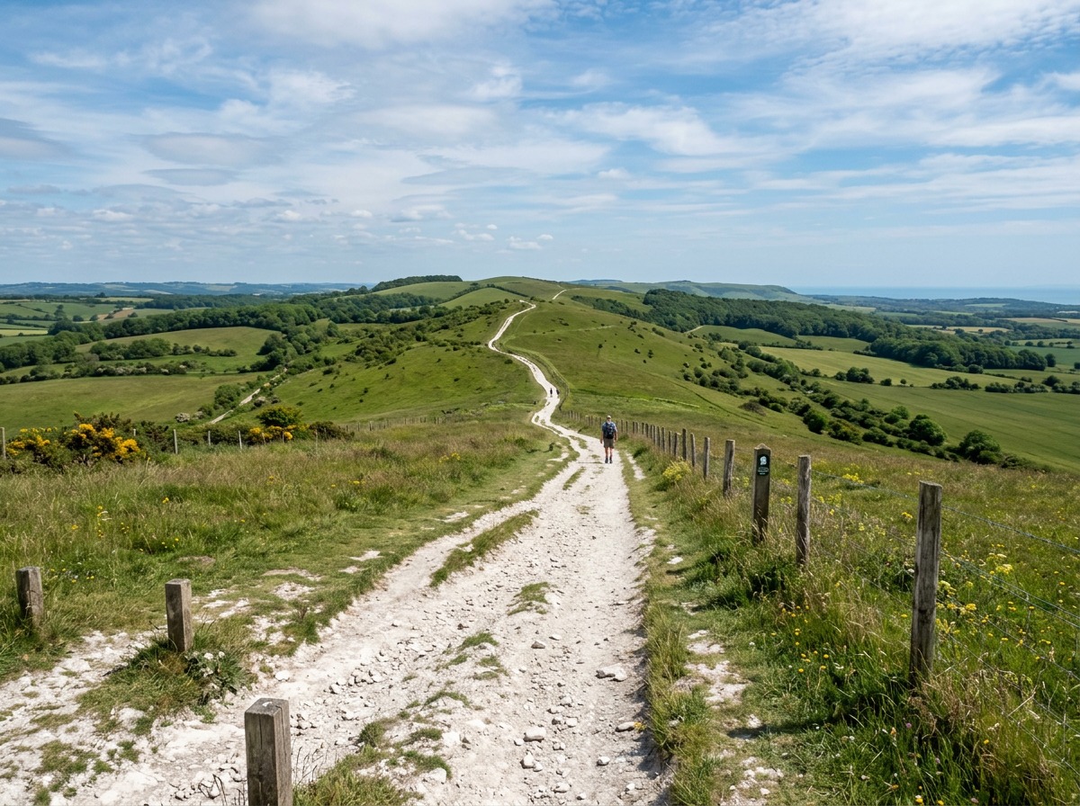
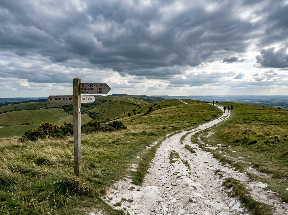
Ditchling Beacon sits directly on the South Downs Way, the 100-mile national trail running the full length of the Downs from Winchester to Eastbourne. The most popular day walk heads west along the ridge to Devil's Dyke, covering roughly four miles with sweeping views in both directions. The route is mostly level along the ridgeline, making it accessible for confident walkers of moderate fitness.
For a shorter outing, the circular walk from the car park takes in the summit, the nature reserve and the views north across the Weald, returning via the bridleway in about an hour. Longer routes descend northward through Westmeston to the village of Ditchling, known for its arts and crafts heritage and the Ditchling Museum of Art + Craft.
The National Trust car park sits right at the summit, just off Ditchling Road. Non-members pay three pounds per day by cash or using the PayByPhone app (location number 803351). National Trust members park free. The car park can fill quickly on sunny weekends, so arriving before 10am is advisable.
Without a car, the 79 Breeze Up to the Downs bus runs from Brighton to the Beacon at weekends and during summer months. The nearest railway station is Hassocks, served by Thameslink, from which a signed footpath climbs to the summit in about 45 minutes. The Beacon is fully exposed with no shelter, toilets or refreshment facilities at the top, so bring water, sun protection and waterproofs as conditions change quickly on the ridge.
Ditchling Beacon is entirely free to visit on foot — the only charge is for non-National Trust members using the summit car park
The small National Trust car park at the summit fills quickly on sunny days, especially between May and September. Aim to arrive before 10am or use the 79 bus instead.
There are no facilities at the top of the Beacon — no toilets, no cafe and no shelter. The ridge is exposed to wind even on warm days, so pack layers and carry plenty of water.
The four-mile ridge walk along the South Downs Way to Devil's Dyke is the most rewarding route from the Beacon. It follows open downland with views the entire way.
The chalk grassland is at its best between June and August when rare musk orchids and marsh fragrant orchids bloom on the northern escarpment slopes.
The car park machine takes cash only. If you prefer card payment, download the PayByPhone app before arriving and use location number 803351 to pay remotely.

London Travel Writer · 12+ years covering UK attractions and tourism
Last reviewed: March 10, 2026